
Selling the “Front-End” Loss: Thinking Long-Term Profit
Most contractors price every job the same way, using a simple cost plus margin formula, and if the margin is not there, they walk away.
Site preparation used to start with on-site inspections, where workers walked the land, marked rough boundaries, estimated slope visually, and guessed tree density based on experience. While effective, this approach depended heavily on personal judgment. Today, new tools are transforming this process.
Drone mapping is revolutionizing land assessment for contractors, especially when combined with AI analysis, transforming site planning from guesswork into data-driven decisions.
This article explores how drone mapping and AI are shaping the future of site prep, including methods for analyzing drone data to assess slope and vegetation density for smarter decision-making.
Why Site Prep Is Becoming Data-Driven
Margins have become slimmer. Fuel prices increase, labor shortages persist, and clients demand precision. Relying on rough estimates can lead to errors; even minor mistakes in slope or density calculations can affect equipment choices, crew size, and schedules. Using drone mapping minimizes uncertainty. Accurate data-based planning helps safeguard profits.
What Drone Mapping Actually Captures
Modern drones collect far more than photos.
With the right software, drones can generate:
This information helps contractors assess land from various perspectives prior to deploying equipment. Proper preparation enhances the execution of the project.
Understanding Slope Through Drone Data
Slope affects everything.
It impacts:
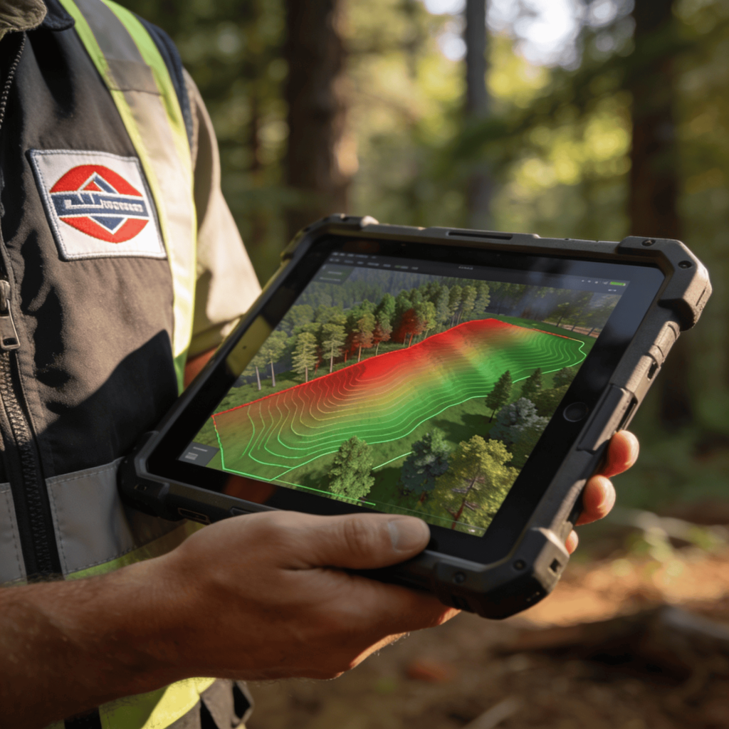
Drone-generated elevation models clearly show slope changes. Instead of guessing grade percentages, you can view contour lines and gradient maps.
AI tools can analyze terrain data and automatically identify steep areas. The result is more accurate planning.
Raw drone footage gives you data, but AI turns it into decisions.
An AI program can:
Instead of examining every detail yourself, you receive the main insights extracted from the data. Summaries facilitate quicker decisions.
Tree and brush density are major factors that significantly affect production rates. Also, dense undergrowth prevents machines from operating at full speed and eventually causes them to wear out more quickly.
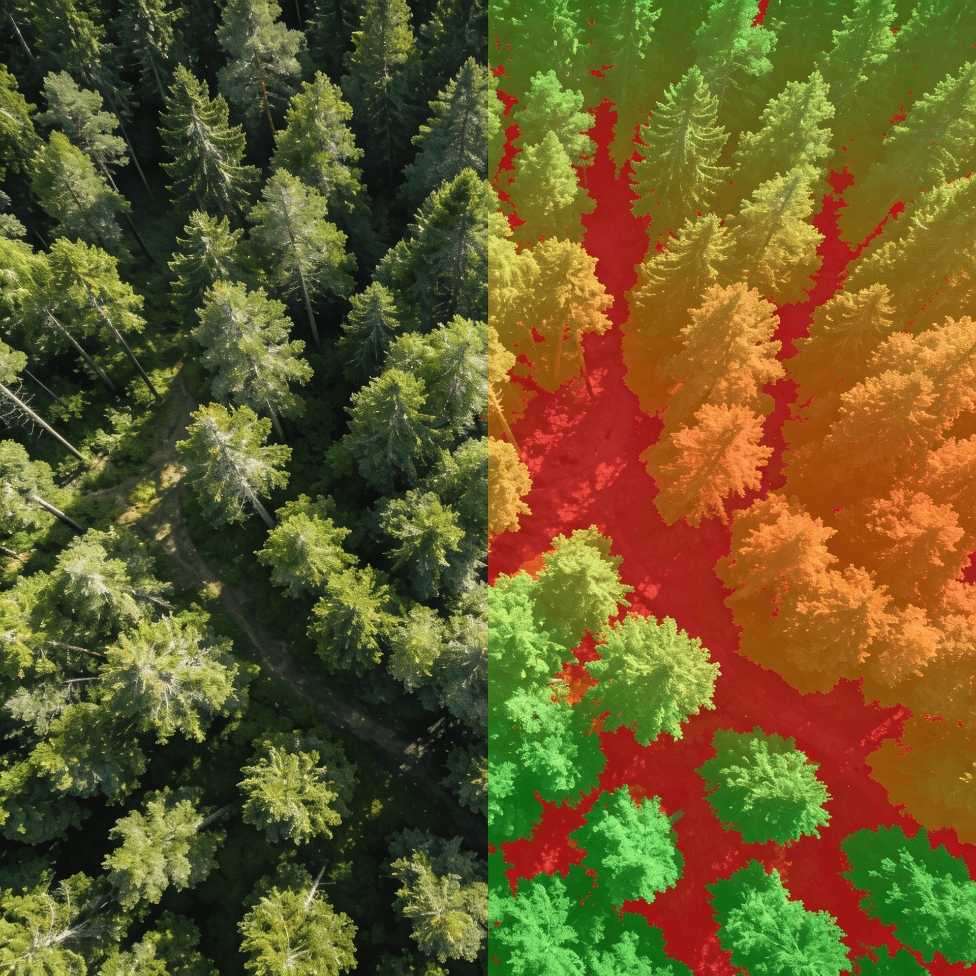
Drone mapping for site preparation can produce canopy and vegetation density overlays. These visuals show thick zones versus lighter areas.
AI tools analyze imagery to estimate biomass levels and categorize vegetation intensity.
This helps you:
Better data reduces underbidding.
Slope and density analysis provide information for optimal equipment planning.
For example:
Making the right choice early on avoids the need for mid-project changes, which can be costly. Proper planning helps save money.
Clients often find it difficult to visualize grading plans, but drone maps provide clear visuals that help them better understand them.
Showing:
Providing detailed maps rather than rough sketches builds trust with clients, as it demonstrates professionalism. A polished presentation can also justify higher pricing.
Rework considerably cuts into profit margins. Wrong slope assumptions cause drainage issues, and errors in density estimates lead to higher labor costs. Using drone mapping paired with AI analysis can significantly reduce unexpected issues during projects. The fewer surprises encountered, the smoother the project flow. More streamlined projects ultimately enhance profit management.
Traditional site evaluation is time-consuming. Drone mapping simplifies this process significantly. Instead of hours spent navigating rough terrain on foot, a single drone flight can collect all necessary data in just a few minutes. The data is then quickly processed with AI software at the office. Faster estimates result in higher close rates.
Risks arise from steep slopes, concealed drop-offs, and unstable terrain. Drone mapping helps identify these hazards in advance.
AI, based analysis shows spots that have:
Being well-informed enables the team to create an effective safety plan.
Operations that involve fewer risks can also reduce liabilities.
Regulations concerning erosion and runoff are becoming stricter. Drone mapping aids in documenting these changes.
You can archive:
AI analysis assists in demonstrating adherence to environmental guidelines. Documentation not only protects your business but also fulfills multiple other functions.
Many contractors still rely only on visual estimates. Using drone mapping during site preparation can position your company as a pioneer. When clients review bids, those with detailed analyses tend to be the most appealing.
This is essentially a communication of:
The latter perception justifies charging higher prices.
Drone adoption works best when integrated into systems.
Create a process:
Structured workflows optimize the value derived from technology. Without proper processes, technology can lead to confusion.
You do not need a full-time surveyor.
Operators and estimators can be trained to:
Understanding data fosters confidence, which in turn enhances the quality of decisions.
Drone equipment and software require investment.
However, consider:
These savings frequently surpass equipment expenses in the long run. Efficiency continues to build.
Drone mapping has huge potential for:
Data analysis is most effective with areas that have high terrain variation. In contrast, simple lots tend to be less complex.
By 2030, data-driven preparation is expected to become standard. Early adopters will benefit from gaining experience and refining their workflows. Despite advancements like drone mapping and AI analysis, skilled operators will still be essential. These operators will enhance their accuracy, which in turn safeguards profits.
Technology aids judgment but does not replace it. Skilled operators continue to interpret soil feel, moisture levels, and access issues.
The strongest contractors combine:
Balance creates advantage.
Drones and AI are crucial in the future of site prep, reducing guesswork with precise measurement data. For instance, analyzing aerial drone data for slope and vegetation density can significantly aid in selecting the right equipment, estimating costs accurately, and planning projects. Contractors using drone mapping now will understand their sites better and work more efficiently in the future.
A company that adopts smarter preparation experiences smoother execution, which in turn fosters stronger business growth.

Most contractors price every job the same way, using a simple cost plus margin formula, and if the margin is not there, they walk away.

More marketing doesn’t always lead to more growth; sometimes it results in wasted expenditure. Many contractors invest in ads without realizing they are already ranking
When work diminishes, the simplest solution often appears straightforward: buy leads. Platforms claim to offer exposure, steady inquiries, and growth without additional marketing. For many

Most contractors compete for attention, but few focus on building trust. In competitive markets, attracting attention is easy through paid ads, but earning trust is

In excavation, skill is important, but first impressions matter more. Before a client assesses your grading or speed, they form an opinion based on your

Most contractor websites tend to look similar, featuring stock photos of excavators, generic quality statements, a list of services, and a phone number at the

Before ads, SEO, or social media, there is Rule Number Zero: protect and grow your reviews. In today’s market, your Google profile often forms the

Most contractors complete a job and leave without collecting money on the invoice; instead, they leave an impression on the street. When you finish a
Most contractors believe growth begins with advertising. However, true growth in excavation businesses starts with a solid foundation and referrals. Leading companies in this field